


Introduction
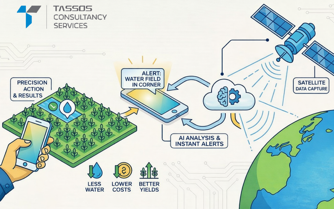
Drone mapping combines unmanned aerial vehicles, advanced sensors, and intelligent software to capture highly accurate spatial data. This technology is transforming agriculture and surveying by providing precision, speed, and cost-effectiveness that traditional methods cannot match.
What Is Drone Mapping?
Drone mapping uses drones equipped with cameras or sensors to capture aerial data, which is processed into maps, 3D models, and analytical reports. Common outputs include:
- Orthomosaic maps – High-resolution overhead views
- Digital Elevation Models (DEM) – Terrain elevation data
- 3D point clouds – Detailed surface representations
- NDVI maps – Vegetation health indicators
This data enables professionals to make informed, data-driven decisions with exceptional accuracy.
Transforming Agriculture
Drone mapping is central to precision farming, allowing farmers to move beyond manual inspections and guesswork. Key applications include:
- Crop health monitoring using multispectral sensors to identify stress zones
- Early detection of pests, diseases, and nutrient deficiencies
- Soil and moisture assessment to understand field variability
- Irrigation planning based on actual crop needs
- Yield estimation for optimized harvest planning
By providing real-time insights, drones help farmers reduce input costs, improve productivity, and promote sustainable practices.
Key Benefits for Farmers
Precision targeting allows farmers to treat specific problem areas rather than entire fields, cutting chemical usage by 20-30% while maintaining yields.
Early problem detection identifies issues like disease outbreaks when they’re still manageable, minimizing crop losses.
Time efficiency enables drones to cover large fields in hours instead of days, allowing more frequent monitoring throughout the growing season.
Lower costs compared to manned surveys make precision agriculture accessible to farms of various sizes.
Revolutionizing Land Surveying
Drone mapping has transformed traditional surveying by offering faster data collection and safer operations. Applications include:
- Topographic and boundary surveys with precise property lines and elevation contours
- Construction site monitoring to track progress and manage earthwork
- Volume calculations for mining and quarries
- Urban planning for infrastructure development
- Environmental surveys for conservation and erosion monitoring
Drones easily access difficult or hazardous terrains, reducing human risk while maintaining high accuracy.
Advantages for Surveyors
Rapid data collection means a drone can survey hundreds of acres in a day, versus weeks with traditional methods.
Centimeter-level accuracy meets or exceeds surveying standards when using RTK/PPK GPS.
Reduced manpower allows a two-person drone crew to accomplish what previously required five or six people.
Enhanced safety protects personnel by surveying hazardous locations remotely.
Seamless integration with GIS and CAD software eliminates time-consuming data conversion.
Core Technologies
Drone mapping relies on integrated technologies that work together:
- High-resolution RGB cameras for detailed visual mapping
- Multispectral sensors for vegetation analysis and crop health
- Thermal cameras for water stress and heat detection
- LiDAR systems for precise terrain modeling under vegetation
- AI and photogrammetry software for automated data processing
These technologies convert raw aerial images into actionable intelligence.
Challenges to Consider
Regulatory restrictions require operators to navigate varying rules and obtain proper permissions.
Weather dependency can delay operations, as wind, rain, and poor lighting affect flight and data quality.
Initial investment in quality equipment and software can reach tens of thousands of dollars.
Skilled operators are essential, as effective mapping requires expertise in flight planning and data processing.
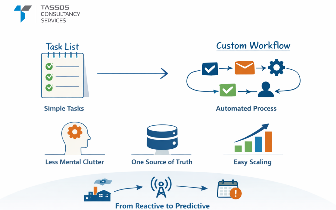
However, as technology matures and regulations clarify, these barriers continue to diminish.
The Future Ahead
Emerging trends will further enhance drone mapping capabilities:
- AI-driven diagnostics that identify problems and recommend specific treatments
- Automated workflows with minimal human intervention
- Smart platform integration for holistic decision-making
- Cloud-based collaboration enabling instant data access from anywhere
As battery technology improves and 5G connectivity expands, drones will enable near-real-time processing and decision-making in the field.
Conclusion
Drone mapping represents a fundamental shift in land management. By delivering precise, real-time data from above, it empowers farmers to grow smarter and surveyors to work faster and safer. As technology evolves with smarter sensors, more capable drones, and powerful AI, drone mapping will play an increasingly vital role in building a more efficient, sustainable, and data-driven future for agriculture and surveying.
***
Keywords:
drone mapping technology, drone mapping in agriculture, drone surveying solutions, precision agriculture drones, agricultural drone mapping, land surveying with drones, UAV mapping services, drone photogrammetry, AI drone mapping, GIS drone mapping, orthomosaic mapping, digital elevation model DEM, 3D point cloud mapping, NDVI drone mapping, crop health monitoring drones, multispectral drone sensors, thermal drone imaging agriculture, LiDAR drone surveying, precision farming technology, smart agriculture drones, soil moisture mapping drones, irrigation planning drones, yield estimation using drones, pest detection drones agriculture, farm mapping solutions, topographic drone survey, construction site drone mapping, volume calculation drones, mining survey drones, urban planning drone mapping, environmental monitoring drones, boundary survey drones, RTK PPK drone mapping, high accuracy drone survey, automated drone mapping, AI photogrammetry software, aerial mapping solutions, drone based land management, smart farming technology, sustainable agriculture drones, real time drone mapping, cloud based drone mapping, GIS CAD drone integration, remote sensing with drones, UAV land survey, future of drone mapping, intelligent mapping systems, drone data analytics, advanced surveying technology, next generation mapping, geospatial drone solutions, agriculture technology innovation, surveying automation, drone mapping services industry.

0 Comments