


Introduction
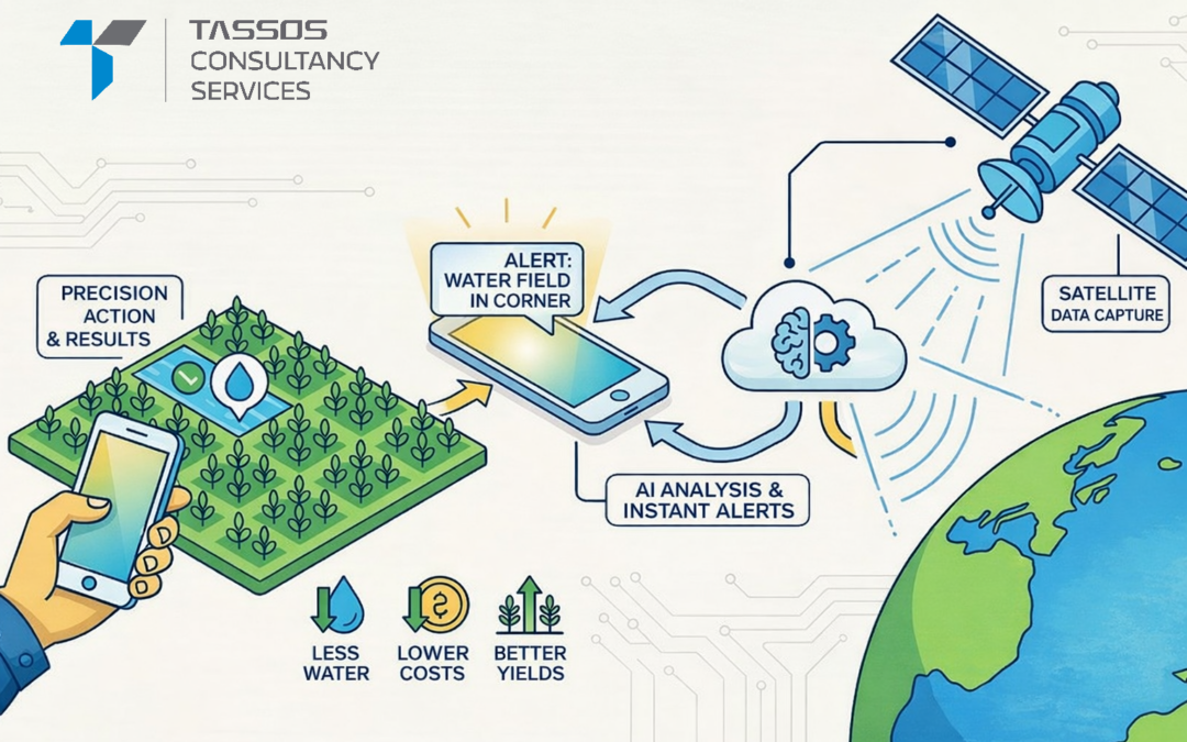
Geographic Information Systems (GIS) have traditionally relied on satellite imagery and ground surveys—methods that are expensive, time-consuming, and limited in resolution. The combination of drones and Artificial Intelligence is changing everything. By capturing ultra-high-resolution aerial data and processing it intelligently, this technology is transforming GIS mapping with unprecedented speed and accuracy.
Why Drones Are Game-Changers for GIS
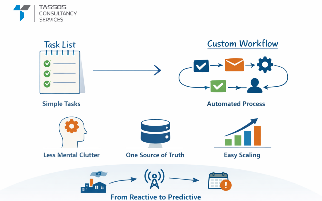
Drones offer flexibility that satellites and ground surveys cannot match. They fly at low altitudes, capture targeted areas on demand, and provide detailed imagery at a fraction of traditional costs. However, the massive data volumes they generate require intelligent processing—that’s where AI becomes essential.
How AI Transforms Drone Data
AI algorithms automatically convert raw drone imagery into actionable geospatial intelligence. Machine learning and computer vision can identify patterns and changes in hours that would take humans weeks to detect.
AI capabilities include:
- Automated classification of land features and objects
- Detection of buildings, roads, vegetation, and water bodies
- Time-based change detection and analysis
- Creation of 3D terrain models and orthomosaic maps
- Precise elevation mapping and contour generation
Real-World Applications
Urban Planning: Monitor city expansion, manage infrastructure assets, and map traffic patterns for smart city development.
Agriculture: Assess crop health, predict yields, analyze soil conditions, and optimize irrigation systems.
Disaster Response: Map floods and wildfires in real-time, rapidly assess damage after disasters, and plan emergency responses.
Construction: Survey sites, monitor project progress, calculate volumes, and detect structural issues early.
The Power of Predictive Intelligence
Unlike traditional static maps, AI-driven drone GIS provides near real-time updates and predictive capabilities. AI models can forecast flood-prone zones, identify early land degradation signs, and support proactive decision-making before problems escalate.
Key Challenges
Data Management: Storing and processing massive volumes of high-resolution imagery requires robust cloud infrastructure.
Regulation: Navigating airspace restrictions and obtaining flight permissions remains complex.
Privacy: Aerial data collection raises legitimate privacy and security concerns that must be addressed.
Accuracy: Ensuring AI model reliability and validating outputs is critical for trustworthy results.
The Future Ahead
The technology is evolving rapidly toward fully automated workflows, integration with IoT sensors, and AI-driven digital twins of entire cities. Edge AI processing will enable immediate on-site analysis, while increasingly sophisticated models will deliver unprecedented spatial intelligence.
Conclusion
AI-powered drone analysis is revolutionizing how we collect, process, and understand geospatial data. This combination accelerates mapping, enhances accuracy, and unlocks insights previously impossible to obtain. As location-based intelligence becomes increasingly critical, AI-drone GIS solutions will be essential for smart planning, sustainable development, and informed decision-making across all industries.
***
Keywords :
AI drone GIS, drone mapping technology, AI in GIS mapping, drone data analysis, artificial intelligence in geospatial, GIS drone solutions, AI powered drones, drone GIS mapping, smart GIS technology, aerial data analytics, drone surveying, AI geospatial intelligence, drone imagery processing, computer vision in GIS, machine learning in geospatial analysis, high resolution drone imagery, real time GIS mapping, 3D terrain mapping, orthomosaic mapping, digital elevation models, automated land classification, urban planning with drones, smart city GIS solutions, agriculture drone mapping, precision agriculture drones, disaster response drone mapping, flood mapping using drones, wildfire monitoring drones, construction site drone surveys, infrastructure mapping with drones, predictive geospatial analytics, AI based change detection, spatial data intelligence, drone photogrammetry, cloud based GIS processing, edge AI drone analysis, digital twin cities GIS, environmental monitoring drones, land use land cover mapping, remote sensing with drones, automated GIS workflows, drone based spatial analysis, terrain modeling with AI, volumetric analysis drones, geospatial big data, intelligent mapping solutions, UAV GIS applications, AI spatial modeling, location intelligence solutions, advanced GIS technology, next generation GIS mapping, smart mapping systems, drone powered GIS analytics, future of GIS technology

0 Comments